
Optimising the National Grid with LiDAR Technology
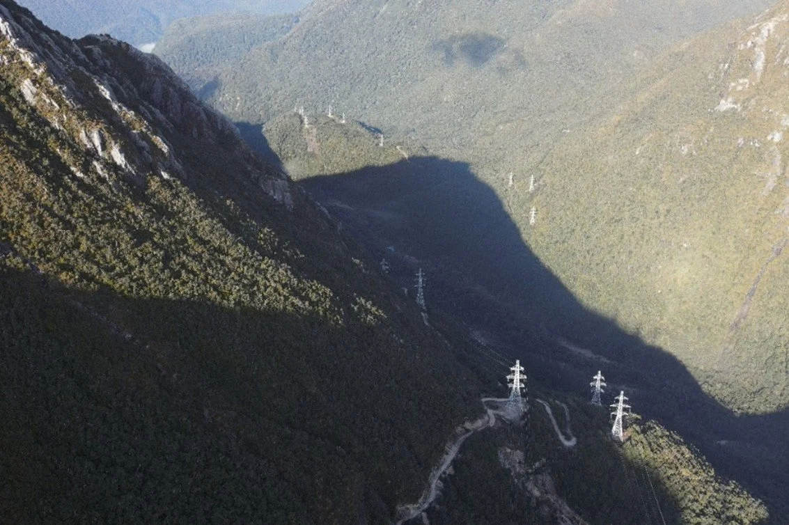
Transpower New Zealand Limited owns and operates the National Grid, the high voltage transmission network connecting areas of generation with towns and cities across New Zealand. The National Grid is a nationally significant asset.
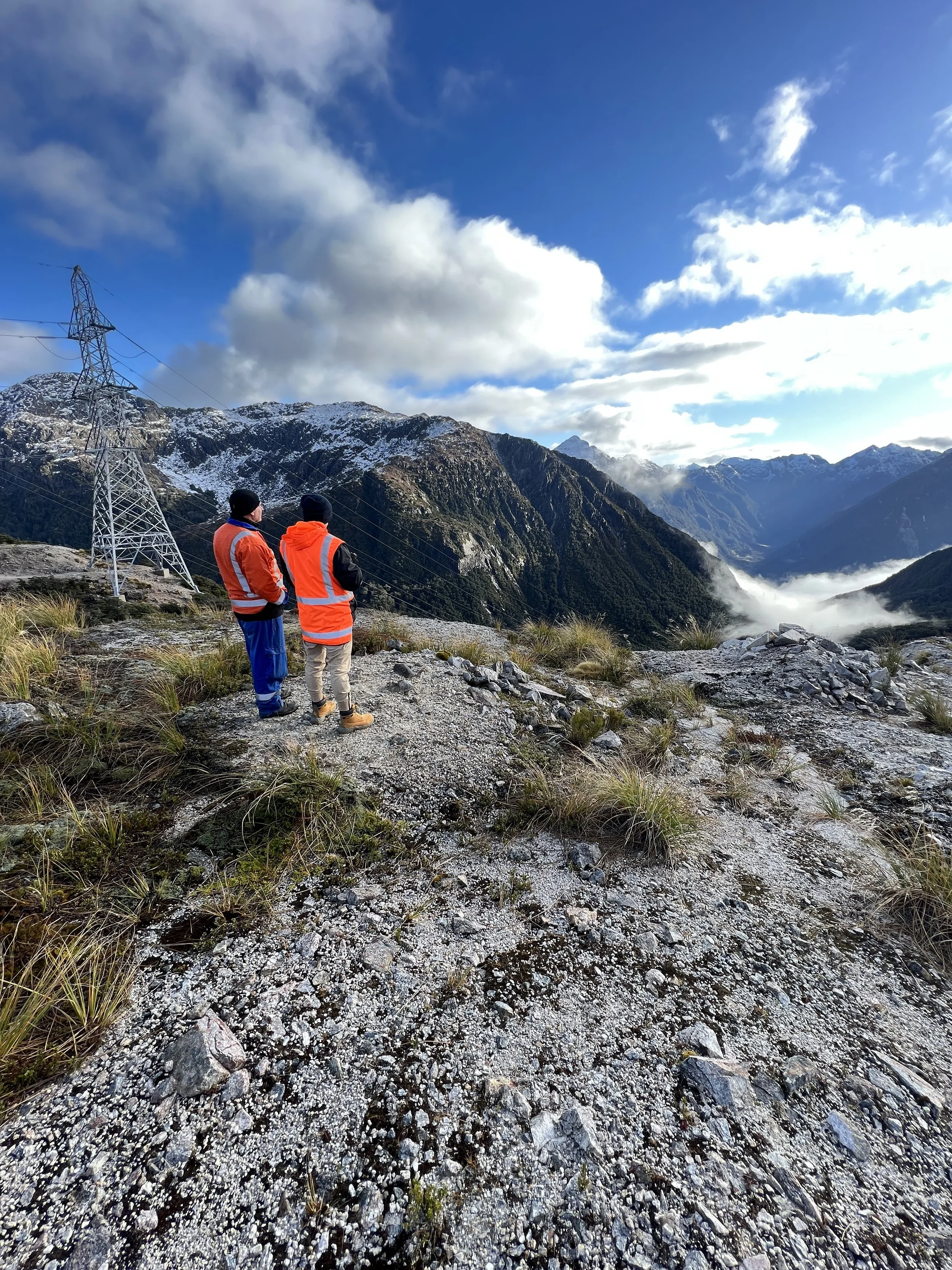
Most inspection and maintenance work carried out on public Conservation Land (PCL) has historically involved accessing areas by foot or vehicle along formed tracks/roads, and when required using fixed wing aircraft to inspect areas from high above or low flying helicopters to carry out inspections and maintenance using a human sling. However, Transpower’s use of drones is increasing as they are less intrusive, quicker, provide better data, reduce greenhouse gas emissions, and are safer to operate.
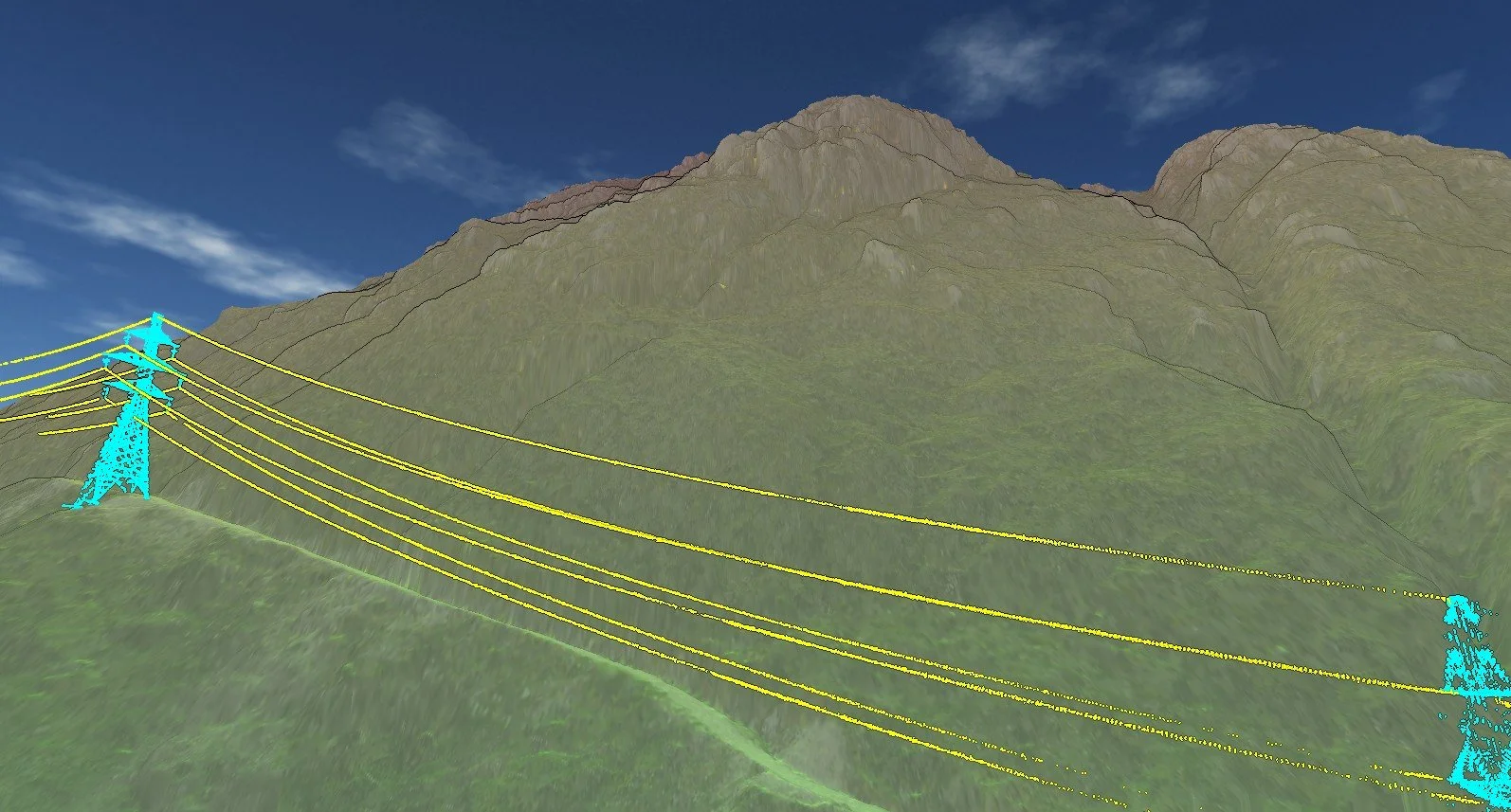
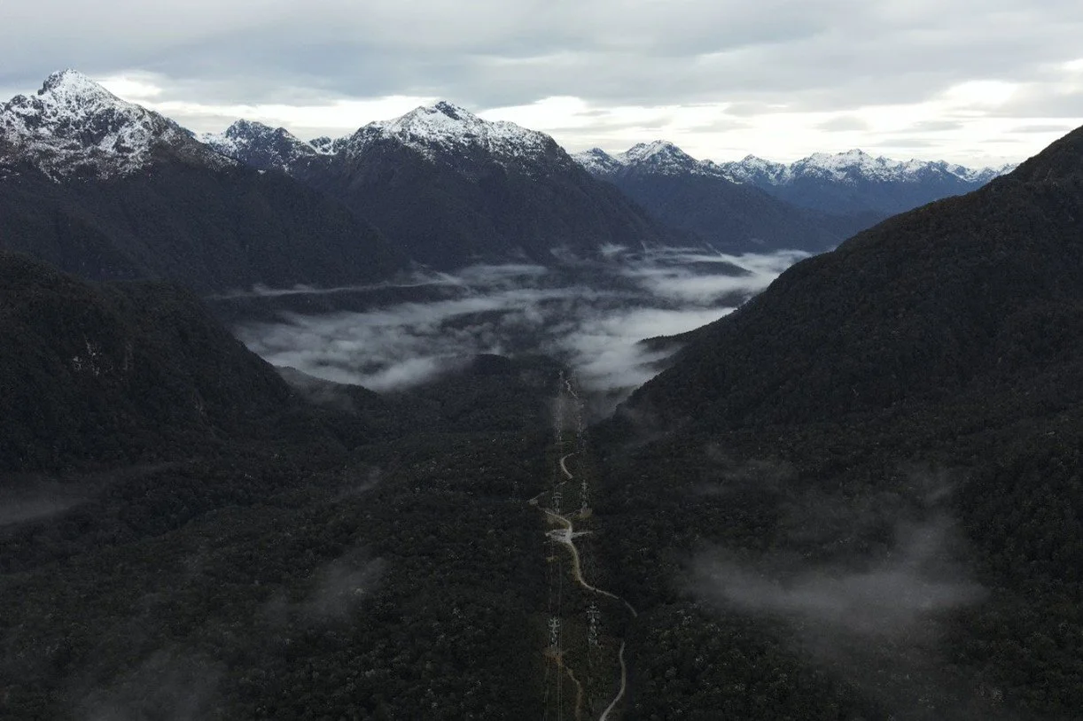
Transpower required 3 different remote sites in Fiordland National Park to be surveyed using LiDAR and capturing aerial photography. Due to the size and complexity of the sites, data capture via UAV was recommended.
“It’s DOC land but Transpower maintains an access way through Fiordland National Park to be able to access our assets, which run from Manapōuri Hydro Station through to the far edge of the park. Transpower’s transmission lines export outpower that is critical to the supply of the Southland region”, said Dushka More, Investigations Project Manager, Transpower.
‘We held an investigation into the access way, and with the help of our local Service Provider and geotechnical engineers, we identified three key risk areas. The first step was to then find a supplier who could capture some detailed imagery at the three identified risk areas as a key input towards assessing the terrain and how to proceed with any risk mitigations”, said Dushka.
Transpower Survey using LiDAR
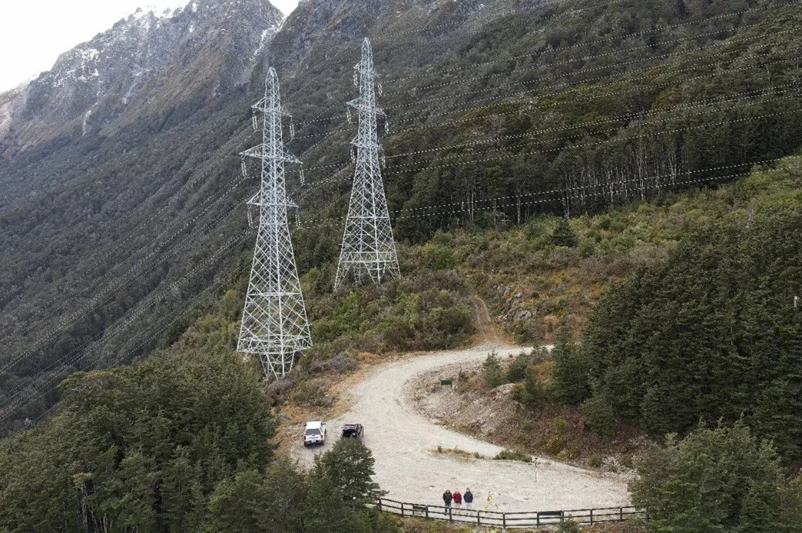
Recon Ltd was up for the adventure and mobilised a team. The journey required boat access across Lake Manapouri to get to the hydro Station, then a walk to access the track for The Percy Saddle. A trip back across the lake and drive to the far side of the park then allowed access along kilometres of remote track to the Hanging Valley and Grebe Lookout areas. Adherence to safety requirements and awareness of the overhead transmission lines and the highly changeable environment in this remote and unique area of NZ was key to the success of the work.
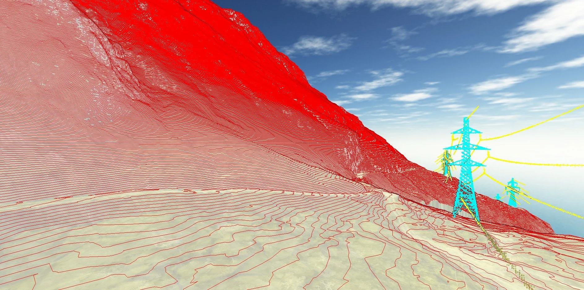
“When undertaking a task like this, it was important to understand the complexities of the environment we were operating in. Time was spent to carefully plan potential launch locations, making assumptions on how Line of Sight (LOS) rules could likely be adhered to. Plenty of contingency was key. Often when our team gets to these complex sites, we find that computer planning is not reality, and other environmental factors mean we can’t operate the way we planned. Fortunately, our experienced operators had this covered and overcame any difficulties thrown at them. The Recon team were also well-prepared for the changeable conditions which included low rolling fog, and sub 0℃ temperatures. Recon’s CAA Certification to operate utilising our Part 102 privileges meant that we were able to operate at higher altitudes than the standard rules for drone operations in New Zealand. We communicated closely with local manned aircraft operators to safely share the airspace amongst the breathtaking terrain. Our high-tech equipment was able to follow the terrain up and down the mountain, avoiding transmission lines and towers, maintaining consistent height above the ground for the most accurate and consistent data capture. The results speak for themselves. This was an operation I was privileged to be involved in and won’t forget for a long time”. Ben Cook – Recon Operations Manager / Chief Pilot.
The data was collected, with the operators leaving survey marks at each site for future tie in.
“The quality of the imagery gathered using Drone LiDAR technology is so high. It can be saved into these platforms for multiple stakeholders to access and use, and it’s time and date stamped. The detail and measurements provided by these images, which engineers can work with down to whatever millimetre you have specified, are pretty epic and really beneficial” said Dushka
“What was captured was a key input and has been extremely useful. We’ve been able to perform a semi-quantitative analysis of the terrain and risks, allowing our geotechnical engineers to provide us with valuable information. This data has been used to guide the design of the proposed mitigations. Additionally, the imagery has been incredibly useful in conveying the health and safety aspects to our leadership team and personnel entering the area, to emphasise the importance of following processes, as it can be extremely hazardous under certain conditions. As they say, a picture paints a thousand words!” said Dushka.
“We are also working closely with DOC to share the great insights we’ve gained, thanks in part to the key initial inputs from Recon.”
Civil Engineers have been able to utilise the data collected by Recon to support geotechnical assessment, particularly towards designs and safety recommendations to help mitigate risks in areas with landslide and rockfall potential. The LiDAR data provided highly detailed and accurate 3D models of large areas of the terrain, and allowed engineers to precisely analyse elevations, slopes and land features.
“If I did it again, I would ask to capture the entire accessway, getting the width and pitch of the roadway all the way through. This could then be saved as a baseline, to re-survey in future years and capture how the environment and risks are changing”.
“Recon were fantastic, and I’ve already mentioned them for a future project. Jeremy and the team were great and were really responsive outside of the project too. Once they had finished their deliverables, if we had a question or an access issue, they would help”, said Dushka.
Enquiries to Recon can be made through our freephone 0800 732 669 or email info@recon.nz.