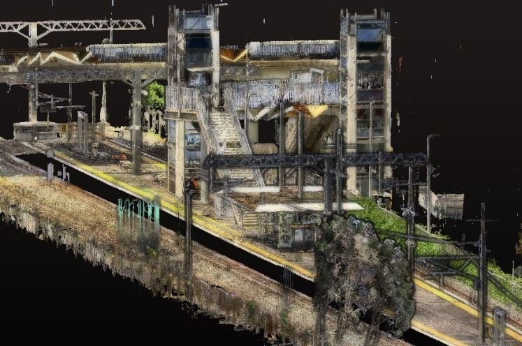
3D Point Cloud Survey
Carrying out 3D point cloud survey work involves precision and consistency to capture accurate scans of built and natural landscapes. This vibrant data provides measurement and spatial data in quick order of an entire site to within millimeter precision. The speed and reliability of 3D point cloud surveys make them an attractive option for reducing time and costs as well as providing valuable information for design, planning and development.
Point Cloud Scanner
We only use the latest point cloud survey equipment from reputable brands such as FARO for our work. We are also trained and experienced in civil and construction surveying enabling us to be a project partner from beginning to end.
Point Cloud Visualisation
3D point cloud surveys provide a rich amount of data in a relatively short space of time. Millions of laser points are directed at an area of concern and the laser beams that return after hitting surfaces form the rich data. Combining all this information creates what is referred to as point cloud data. The data captures technical information such as measurements, but also allows for data visualisation of internal, external, natural and built environments. It comes as no surprise that point cloud surveys are quickly becoming an industry standard practice.

