

Thermal Imaging
Thermal imaging provides invaluable information for mapping geological materials, water content, locating fire hotspots, overheated parts on power structures, heat leaks in thermal insulation and building inspections.
Thermal imaging cameras work by detecting and recording the heat emitted by an object or surface, creating an image that shows the variations in temperature across the object or surface.
Services we provide
Survey and temperature control (optional)
Thermal Imaging
Orthorectification if required
QA & reporting
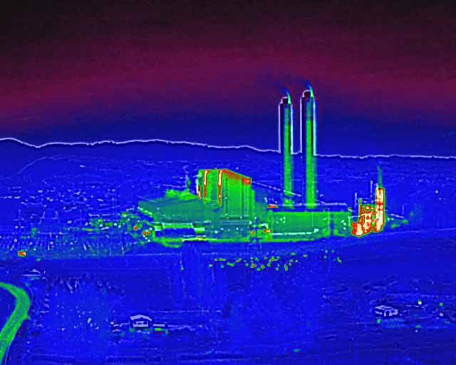
Environmental monitoring
Thermal imaging can be used to monitor the temperature of bodies of water, vegetation, and other natural features. This can help to identify areas of high or low temperature, which may indicate environmental issues such as pollution or climate change.
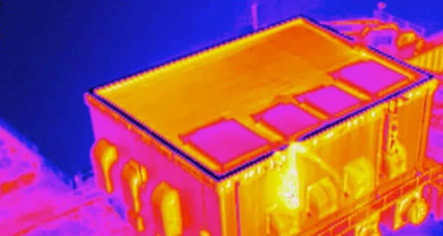
Thermal imaging is used for analysing any scale of plant and equipment, indoor or outdoor. Take the guess work out of inspections by going straight to the source of heat-generating faults.
Energy auditing
Energy loss from building facades and roofs, such as air leaks and poorly insulated areas. Normally completed at night without sun interference. This can help to identify areas where energy efficiency can be improved, reducing energy costs and environmental impact.
Building diagnostics
Moisture and water damage in buildings, as well as electrical faults and other structural issues. This can help to identify problems early, allowing for timely repairs and maintenance.
Thermal imaging is used for analysing any scale of plant and equipment, indoor or outdoor. Take the guess work out of inspections by going straight to the source of heat-generating faults.
Industrial inspections
Thermal imaging can be used to inspect industrial equipment, such as pipelines and machinery, for signs of overheating or wear. This can help to identify potential equipment failures before they occur, preventing downtime and costly repairs.
Thermal data can provide valuable geological information, such as water content and rock type.
-
Building Surveys
Measuring and recording heat loss from building facades and roofs is made simpler with Recon's specialist drone technology. This type of operation is normally completed at night without sun interference.
-
Industrial
Thermal imaging is used for analysing any scale of plant and equipment, indoor or outdoor. Take the guess work out of inspections by going straight to the source of heat-generating faults.
-

Geological Mapping
Thermal data can provide valuable geological information, such as water content and rock type.