
LiDAR vs. Photogrammetry: Decoding the Best 3D Mapping Solution
Both LiDAR and photogrammetry are popular techniques for generating 3D point clouds, but they have distinct differences in how they capture data and their ideal applications. Here’s a comparison of the two:
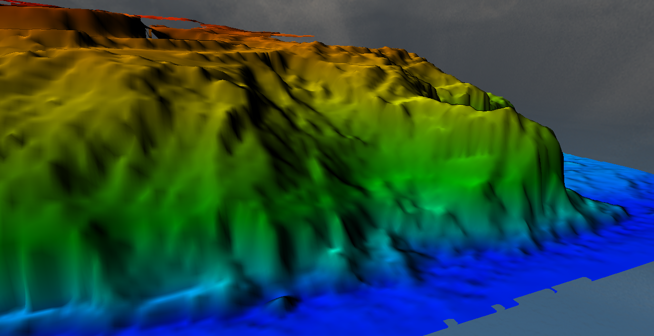
LiDAR DTM of Slip
LiDAR Point Cloud
How it works:
LiDAR uses laser pulses to measure distances to a target.
The time it takes for the laser to return after hitting an object is used to calculate distances, creating a 3D representation of the environment.
Advantages:
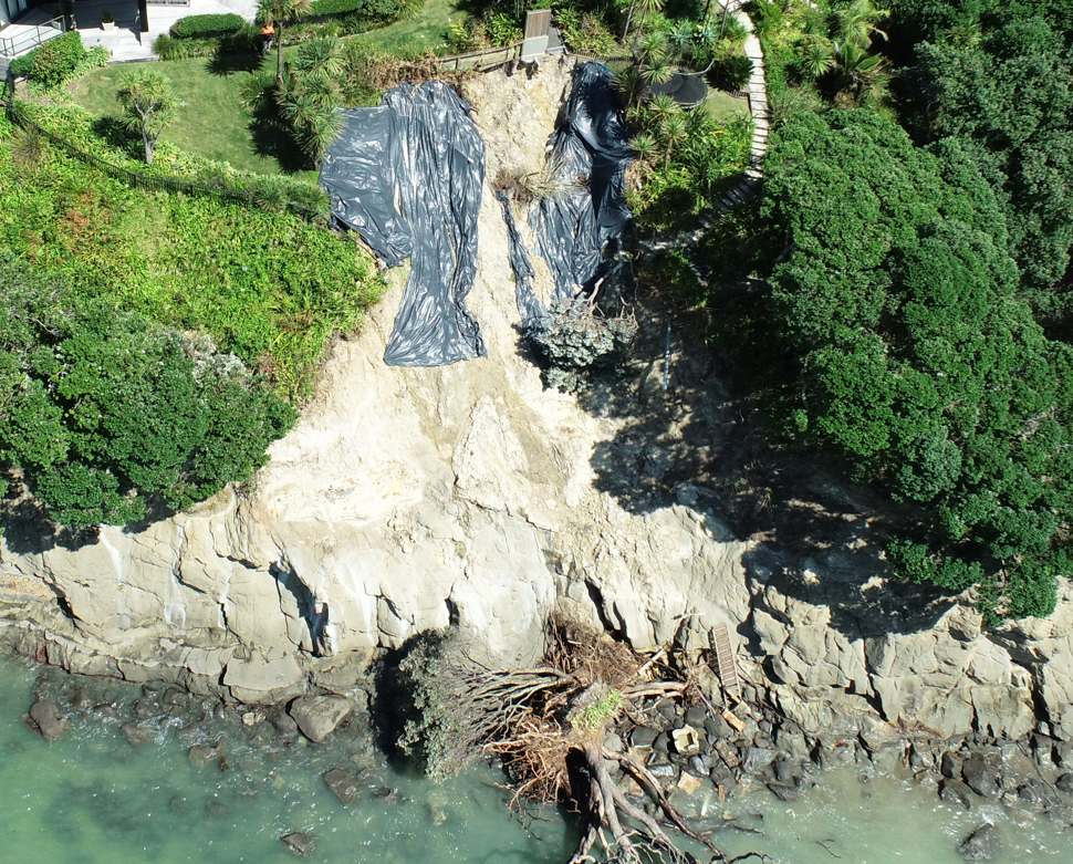
Oblique photo
1. Accuracy and Precision: LiDAR is highly accurate and can capture fine details.
2. Penetration Through Vegetation: LiDAR can penetrate through vegetation and provide ground elevation data even in forested areas.
3. Independence from Light Conditions: LiDAR can be used day or night as it does not rely on external lighting.
4. High Point Density: LiDAR systems can collect a high density of points, providing detailed surface information.
Disadvantages:
1. Cost: LiDAR systems are generally more expensive than photogrammetry equipment.
2. Complexity and Expertise: Requires specialised knowledge to operate and process the data.
3. Weight and Size: LiDAR equipment can be heavier and bulkier, especially in aerial applications.
Photogrammetry Point Cloud
How it works:
Photogrammetry uses photographs taken from multiple angles.
Software analyses the overlap between these images to create a 3D model by identifying common points and triangulating their positions.
Advantages:
1. Cost-Effective: Typically cheaper than LiDAR as it uses standard cameras and drones.
2. Ease of Use: Easier to learn and use; processing software is widely available and user-friendly.
3. Colour Information: Produces point clouds with colour information from the photos, which can be useful for certain applications.
Disadvantages:
1. Light Dependence: Requires good lighting conditions, typically daylight, for capturing quality images.
2. Vegetation and Surface Detail: Cannot penetrate vegetation, making it difficult to capture ground details in forested areas.
3. Accuracy: Generally less accurate than LiDAR, especially in capturing fine details and in areas with less texture.
Which is Best?
The choice between LiDAR and photogrammetry depends on the specific requirements of your project:
LiDAR is best if you need high accuracy and precision, especially in environments with heavy vegetation or when capturing fine surface details is crucial. It’s also preferable for applications that require data collection at night or in low-light conditions.
Photogrammetry is a good choice if you are looking for a cost-effective solution, especially for projects where the area is open and well-lit. It’s also suitable for projects where colour information is important.
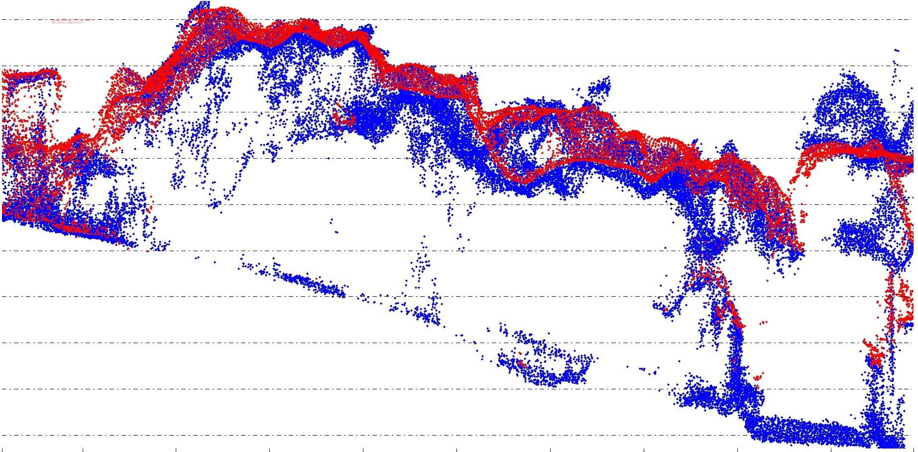
Survey of a landslide, LiDAR (blue) & Photogrammetry (red): LiDAR offers superior ground detail, capturing more precise elevation and surface information compared to photogrammetry.
Enquiries to Recon can be made through freephone 0800 732 669 or email info@recon.nz